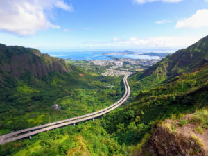
Do you like the good news or the bad news first? Do you shovel down your peas and carrots and reserve the juiciest victuals to savor last? That’s the question you face when you approach the 2.5-mile loop trail that begins at the Hawaii Nature Center in moist, but magnificent, Makiki Valley. The loop is a combination of three trails. As you stand at the trailhead, to the left is Kanealole, to the right, Maunalaha — both named after the streams that run alongside them. These parallel trails are connected at the far end by the Makiki Valley Trail, which strung together form an enjoyable outing for the family.
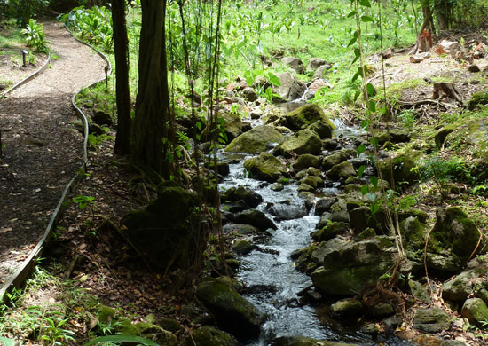
Go left and you have a leisurely stroll past a storybook bubbling brook, go right and you’re facing a beastly incline veined with a maze of knotted roots and rocks. For me, getting the peas and carrots out of the way, means going down the barren slope rather than up it. At the starting juncture, I turn left onto Kanealole and begin with a mild ascent. I meander past the pretty brook, over a quaint bridge and look up in awe at the monumental sheet of vines draping the valley’s highest trees.
A series of chirps and warbles rings out, causing fellow hikers to grab their cameras and look into the canopy for the cute culprits. Parrots and other exotic birds have been sighted in surrounding areas. As local lore has it, they’re a vestige of Paradise Park, a bird park that once operated in Manoa, the next valley over.
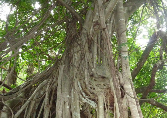
Along the path, tree branches form tunnels that provide ample shade and breezes come whooshing by even on a hot day. Banyan roots clamber over each other, twisting at strange angles as they grip the ground, their aerial roots dangling overhead. Amble into a gulch, crossing over a couple of streams, past heavily laden mountain apple trees, and gradually climb to a view of the valley stretching to the sea.
The most important junction pops up midway through the trail, just as you pass the ocean view and scramble up some makeshift steps. At the top, a rest bench sits on the right. To the left is Ualakaa Trail, which leads upward into an endless maze of trails where a person could literally get lost for days. Be sure to continue straight, veering downward onto Maunalaha.
I feel a tinge of guilt mixed with relief as I watch fellow hikers panting up the steep, dry hill while I traipse down, gingerly picking my way over the roots and rocks. Amazingly, I see whole families, from babes in slings to the elderly inching their way uphill. Still, I prefer my lazy clockwise route. It’s nearly as satisfying as a cone of shave ice, which may just hit the spot perfectly by the time you’ve completed the loop. It’s all about saving the best for last.
TRAIL: Makiki Valley Loop Trail
LENGTH: 2.5 miles
HOW TO GET THERE: From Waikiki, take Ala Wai Boulevard to Kalaukaua Avenue and turn right. Go right again at South King Street, and immediately turn left onto Punahou street. Go left at Nehoa Street, and take the second right onto Makiki Street, veering left onto Makiki Heights Drive. Just before the road curves sharply left, go strait into the Makiki Valley State Recreation Area. Reach a designated gravel parking lot on the left and proceed up the road on foot to the Hawaii Nature Center, and follow the signs to the trail.